VAMBAY COLONY

Vambay Colony located near Vijayawada beside Ajit Singh Nagar , pipula road, Krishna District, Andhra Pradesh. Government made few citizens to vacate some houses in Vijayawada and got them new houses constructed in Vambaby colony. People go to Ajit singh nagar for daily purchases.

Ravindra Bharathi Public School is there in pipula Road.

Contents

PinCode :

520015

Others :

Water Tank

Sub Station

VMC Disney land

VAMBAY COLONY Map :

Payakapuram

Payakapuram

Payakapuram is located in Vijayawada Rural region, Krishna District, Andhra Pradesh. Payakapuram is 8 Km away form Vijayawada. It is situated between Vijayawada and Nuzvid. Payakapuram lies next to Ajit Singh Nagar. Initial it is called as NSCB Nagar and later named as Payakapuram. An Ayurveda research institute is established in payakapuram. It is observed that there is a lot of growth in the field of real estate.

Population :

~30000

Areas inside Payakapuram :

LBS Nagar,

Kavithas,

Kandrika, a flood prone region.

Education :

Municipal Elementary School

Government Jr college

Hospital :

Chikitsa Hospital

Bus Service:

48kr, 48rk

r-rajiv nagar , k- kandrika (rk -first, to Rajiv Nagar and to Kandrika & kr- first, to rajiv nagar and then to Kandrika)

Pin code:

520015

Others:

Police Station

Post Office

Theaters:

Santosh

Map :

Nunna

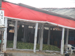
Nunna is located in Vijayawada Rural,Krishna District, Andhra Pradesh. Around 10 km from Vijayawada comes via Vijayawada to nunna-Mango marketnuzvid road. Nunna cover with 12 wards , Nunna is famous for mango market 1 km from center which export mango’s
to  many states.  Huge growth in Real Estate.

Population :

Total population : 10000

Education :

Ravindra Bharathi School

Zilla Parishad High School

Sri Chaitanya Techno School

Kennedy School

Vikas College of Engineering and Technology

Temple :

Ramalayamsri kodanda ramalayam-nunna

Occupation :

Farmers, business people,  industrial workers

Bus route :

49, 48N, 208, 212,

All buses heading to Nuzvid from Vijayawada.

Pin code :

521212

Telephone code:

0866

Hospital

Nikhil Dental Clinic

Veterinary Hospital

Lok Sabhaconstituency:

Machilipatnam

Vidhan Sabhaconstituency/Assembly :

Gannavaram

others:

state bank, sub station

 Map:


Surampalli

Surampalli is located near Gannavaram Mandal, Vijayawada, Krishna District, Andhra Pradesh. 18 km from Vijayawada city, it is located between Vijayawada and Nuzvid. It is 12 km  from Gannavarm. located between Gannvaram and Nuzvid.

Education:

Paladugu Parvathi Devi College of Engineering and Technology(PPDV)
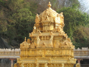
Temple :

Sri Bhramaramba Mallikarjuna Swamy Vari Temple

Industries :

Industrial estate is established in 2008 with 150 companies. 90’s estates are active. Most of them are small scale industries. Dal ,Rice Mills, Soap, cakes, cherry and sports wear industries are present. A total of 400 employees are working there. Most of them are from Surampalli. Agri gold food and farm products are located in Surampalli.

Population :

5000

Occupation :

Farmers, Business people and some work in the industrial estate.

Bus Route :

From Vijayawada 112, 212.

Most Vijayawada to nuzvid service buses will go through the surampalli cross road.

Others :

bank : UCO bank

After polavaram village, the region is developed in industrial and agriculture sector.

Land value :

In 1995   1 acer – 20000 INR

2000 it is 35000

2004-2005  cost of 100000

after polavaram land rates are increased

after 2009  acer cost of 1 crore Rs

Note: land rates are approximate only

Map :


Ajit Singh Nagar

Ajit Singh Nagar is located in Vijayawada, Andhra Pradesh connects via Nunna road after sing nagar flyover. Government construct Sewage treatment plant. Dumping yard total waste will collects and reuse for some other purpose. Games Stadium, Good Road Facility’s. Big growth in Real Estate, and one of the best place to buy land in Vijayawada.

Contents

Occupation :

Realtors , Business, works in construction field.
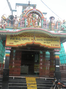
Temple :

Sai Baba Temple

Population :

~ 14000

pincode:

520015

Bus Services :

48, 41N, 208

Most of the buses going from Vijayawada to Nuzvid will go via this route.

Education :

MKBaig Municipal High School

St. Ann’s School

Others:

Sarva Jana Sneha charitable Trust(ssct)

St Ann’s Health Center

Ajit Singh Nagar Map :

Areas in Vijayawada

List of Areas in Vijayawada with pin codes:

Area Name PincodeRemark
Ajith singh nagar520015
Arundelpet 520002
Autonagar520007
Ambapuram520012
Bhavanipuram520012
Bahubalendrunigudem521101
Besant Road520011
Bharathi Nagar520008
Buckinghampet520002
Chittinagar520001
Christurajupuram520005
Currency nagar520008
Chandramoulipuram520010
Durgapuram520003
Durga Agraharam520002
Gandhinagaram 520003
Gannavaram521101
Gollapudi521225
Gudavalli520007
Guru Nanak Colony520004
Gunadala520004
Kesarapalle521102
Hanuman pet520003
Ibrahimpatnam521456
Jaccampudi520012
Jayaprakash Nagar520010
Kamakotinagar520012 Kamakoti Nagar, Vidhyadharpuram, Vijayawada
Kanuru520007
Kedareswar Pet520008
Kothapet520001
Kondapalli521228
Krishnanagar520007
Krishnalanka520013
Lakshminagar520011
LIC Colony520010
Machavaram520004
Madhura Nagar520011
Maruthi nagar
Moghalrajpuram520010
Patamata Lanka520010
Punnamathota520010
Purnanandampet520003
Patamata520010
Payakapuram520015
Satyanarayanapuram520011
Srinivasa Nagar521175
Siddhartha Nagar520010
Suryaraopet520002
Vasanthanagar520007
Venkateswarapuram520010
Veterinary Colony520008
Vidyadharapuram520012
Vinchipeta
Vijayawada Municipal Office520001
Vijawada Railway Junction520001
Vijayawada Bus Stand520013
wynchipet 520001
Yanamalakuduru520007
A.C.Company520003
Vidhyadharpuram520012
Allapuram 521101
Azzampudi 521101
Ashok nagar520007
Ayodhya nagar520003
Chalasani nagar520008
Gunadala520004
guntupalli521241
Housingboard colony520012


Kanaka Durga Devi Temple

Kanaka Durga Devi  Temple is located on Indrakeeladri Hill,  bank of Krisha River ,Vijayawada , Andhra Pradesh.

DurgaDevi Temple Vijayawada

Temple Timings :

Darshanam

04:00 AM – 06:00 PM
06:45 PM – 10:00PM

Sri Malleswara Swamy Abhishekam

05:00 AM to 11:30 AM

Halt for Sri Malleswara Swamy Vari Pancha Harathulu

05:45 PM to 06:30 PM

( please check latest updates in official website – http://kanakadurgamma.org/Darshan )

Type of Darshanas :

Dharma Dharshanam – Free

Mukamandapam Darshanam – 100 Rs

Pratyeka Dharshanam – 20 Rs

Antharalaya Darshanam – 300 Rs

Swarna Pushpaarchana (in 6th floor)  – 650 Rs ( two persons )

Shivaarchana – – 650 Rs ( two persons )

http://kanakadurgamma.org/Darshan

Expected visit time :

Festival season 2-4 hours

Friday – 1hour- 2hours

every day – 30min to 1hour

Biggest Festival:

Dasara/Dussehra

Ten Alankaras of devi during dasara time:

Sri Annapurna Devi
Sri Bala Tripura Sundari
Sri Durga Devi
Sri Gayathri Devi
Sri Lalitha Tripura Sundari Devi
Sri Maha Lakshmi Devi
Sri Maha saraswathi Devi
Sri Mahisha Mardhimni
Sri Raj Rajeshwari Devi
SRI SWARNA KAVACHALAKRUTA DURGA DEVI

 How To Reach:

2.7 km from Vijayawada bus stand.
Bus facilities is available from bus stand, railway station.

Official website :

http://kanakadurgamma.org/


Temple info
http://kanakadurgamma.org/TempleInfo

http://www.durgamma.com/ Alankaras

Daily sevas  :

seva / tour plan online :

http://kanakadurgamma.org/DarshanPlanner

PAROSKYA SEVA
http://kanakadurgamma.org/Kanakadurgamma-Paroskya-Pooja

some more related links :
KADGAMALARCHANA,
Weekly Sevas,
ARCHANA

Sri Durga Malleswara Swamy Varla Devasthanam
Durga Temple Ghat Rd
Vijyawada,
Andhra Pradesh
520001

Map:
    Sources:  http://www.durgamma.com/

Guntur District

Guntur city is is the district head quarters of the Guntur district. It is the biggest city in the Guntur District. Being a high commercial city and with good residential areas, Guntur stands as the third most populous city in Andhra Pradesh. Guntur city is famous for it’s mirchi crops. It is often referred as Mirchi City.The district’s coastline is approximately 100 kilometres . Guntur City is the largest city and the administrative centre of the Guntur District. The district is a major centre for education and learning.

Guntur district acts as a home for many historically significant areas like Amaravati, Kondaveedu Fort, Undavalli caves. In the year 2012, the city got expanded further after expanding the city limits by adding 10 more surrounding villages. The Guntur district’s coastal line is about 100 kilometers.

The Guntur city has many parks, museums, nature conservation sites, forts, resorts and caves making it a good tourism spot. Guntur has a tropical climate which makes it very hot during the summer season(47 C). We can provide several way to promote the climatic conditions of a region.

A number of changes are taking place in the Guntur city since it’s declaration as the capital city of the Andhra Pradesh. Many new businesses are being started. The real estate field is running in it’s full swing. There are lands available for sale and now will be a good time to buy. The details of the regions have been provided in the website as per the regions, feel free to go through it and let us know of any necessary changes regarding the information that is being provided.

Population:

490k


Famous Places:

Amaravathi Buddhist Site

Kondaveedu Fort

Kotappakonda

Brindavan Gardens

Manasa Sarovar


Mangalagiri Mandal -List of Villages with pincode,population,Map

Mangaliri Mandal is one of the mandal out of 57 mandals in guntur district, Andhra Pradesh. which is 20 km from guntur city, Mangaliri Mandal is part of capital of Andhra Pradesh (crda). Headquarter of Mangaliri mandal is located in Mangaliri, Chinavadlapudi is the least populated &Nowlur (Rural)  is the high population village in Manalagiri Mandal.

Number of villages in  Mangaliri Mandal :11

Total Population of Mangalagiri Mandal : 160303

Male population of Mangalagiri Mandal : 80363

Female population of Mangalagiri Mandal : 79940


Villages in Mangalagiri Mandal with Pin codes and population:

S.NoTown / Village NamePincodesNo of HouseholdsPersonsMalesFemales
1.Atmakur (Rural)5225031,4476,1033,0943,009
2.Chinakakani5225081,1554,9932,5962,397
3.Chinavadlapudi522437146482238244
4.Kaza5225081,8367,6874,1413,546
5.Krishnayapalem5225023921,560742818
6.Kuragallu5225021,1054,5102,2722,238
7.Nidamarru5225021,4755,9012,9642,937
8.Nowlur (Rural)5222334,41718,7029,4509,252
9.Nutakki5223032,5999,5124,8394,673
10.Pedavadlapudi5223023,15412,2466,1796,067
11.Ramachandrapuram5223033541,219604615
12Mangalagiri(M+OG)52250328139107,19753,30153,896
13Mangalagiri(M)5225031913773,61336,53237,081

Mangaliri Mandal Map :


Note:

M – Municipality

O.G.- Out Growth